MAP 2025
Ward Map Analysis Report
Naranammoozhy Grama Panchayat
🟢 1. Introduction
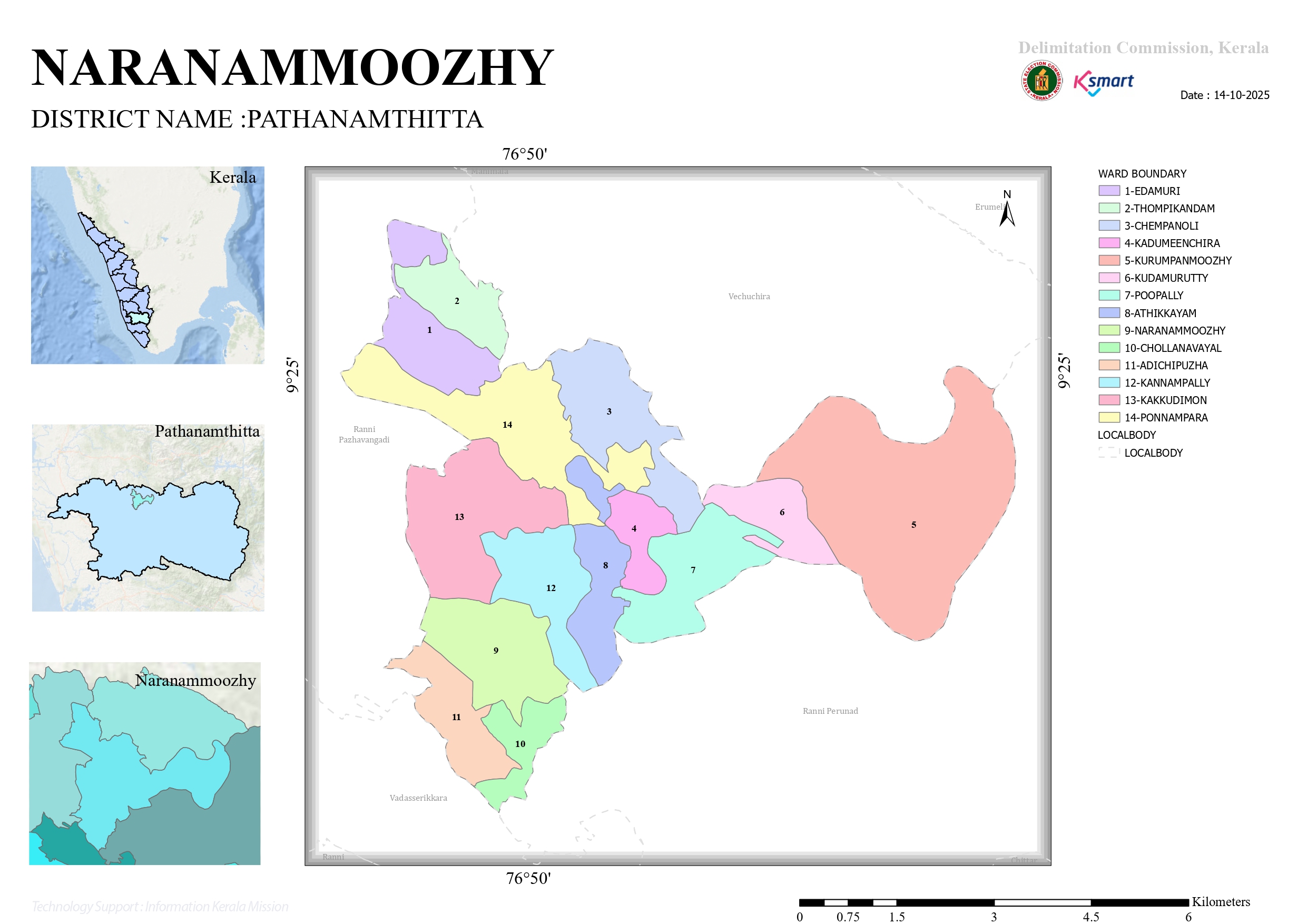
This map shows the ward division and geographical position of Naranammoozhy Grama Panchayat in Pathanamthitta district. It is an official document prepared by the Kerala Delimitation Commission.
🟢 2. Administrative Details
- District: Pathanamthitta
- Panchayat: Naranammoozhy
- Number of Wards: 14
- Date: 14-10-2025
🟢 3. List of Wards
The 14 wards marked on the map are:
- Idamuri
- Thombikkandam
- Chempanoli
- Kadumeenchira
- Kurumbanmuzhi
- Kudamurutti
- Pooppally
- Athikkayam
- Naranammoozhy
- Chollanavayal
- Adichippuzha
- Kannampally
- Kakkudimann
- Ponnampara
🟢 4. Geographical Location
- The Panchayat is located approximately at 9°25' N latitude and 76°50' E longitude.
- The area consists of scenic hills and forest regions.
- Roads connecting various rural areas are clearly marked.
🟢 5. Nearby Areas
Major nearby Panchayats and regions shown on the map:
- Ranni
- Pazhavangadi
- Vadasserikkara
- Vechuchira
- Chittar
- Ranni Perunad
- Erumeli
🟢 6. Features of the Map
- Wards are clearly identifiable with numbering
- Boundaries are distinctly marked
- Scale (0–6 km) helps in understanding distances
- Official GIS-based map (Esri data)
🟢 7. Importance
This map helps to:
- Understand election ward boundaries
- Plan development activities
- Make accurate administrative decisions
- Improve public service delivery
🟢 8. Conclusion
The ward map of Naranammoozhy Grama Panchayat is an important document that supports a transparent and well-structured administrative system. The clear division of 14 wards is highly beneficial for development planning and governance.